Introducing the 16th Edition of the Appalachian Trail Guide to Shenandoah National Park with Side Trails
By Emeline Otey
This hiking guide is one of PATC’s most important trail guides. It is necessary reading for long-distance hikers trekking through SNP and equally informative for hikers out for a day on an interesting or challenging trail. In addition to turn-by-turn descriptions of the trails, the book also contains extensive information about the flora, fauna, and geology of the area as well as trail safety and health information.
John Hedrick, the editor, has drawn upon his extensive knowledge and experience to update this hiking guide to the Appalachian Trail as it traverses the 105 miles of Shenandoah National Park. John plays several volunteer roles in PATC including District Manager of the blue-blazed side trails in the Central section of the SNP, which gives him an in-depth knowledge base of the area.
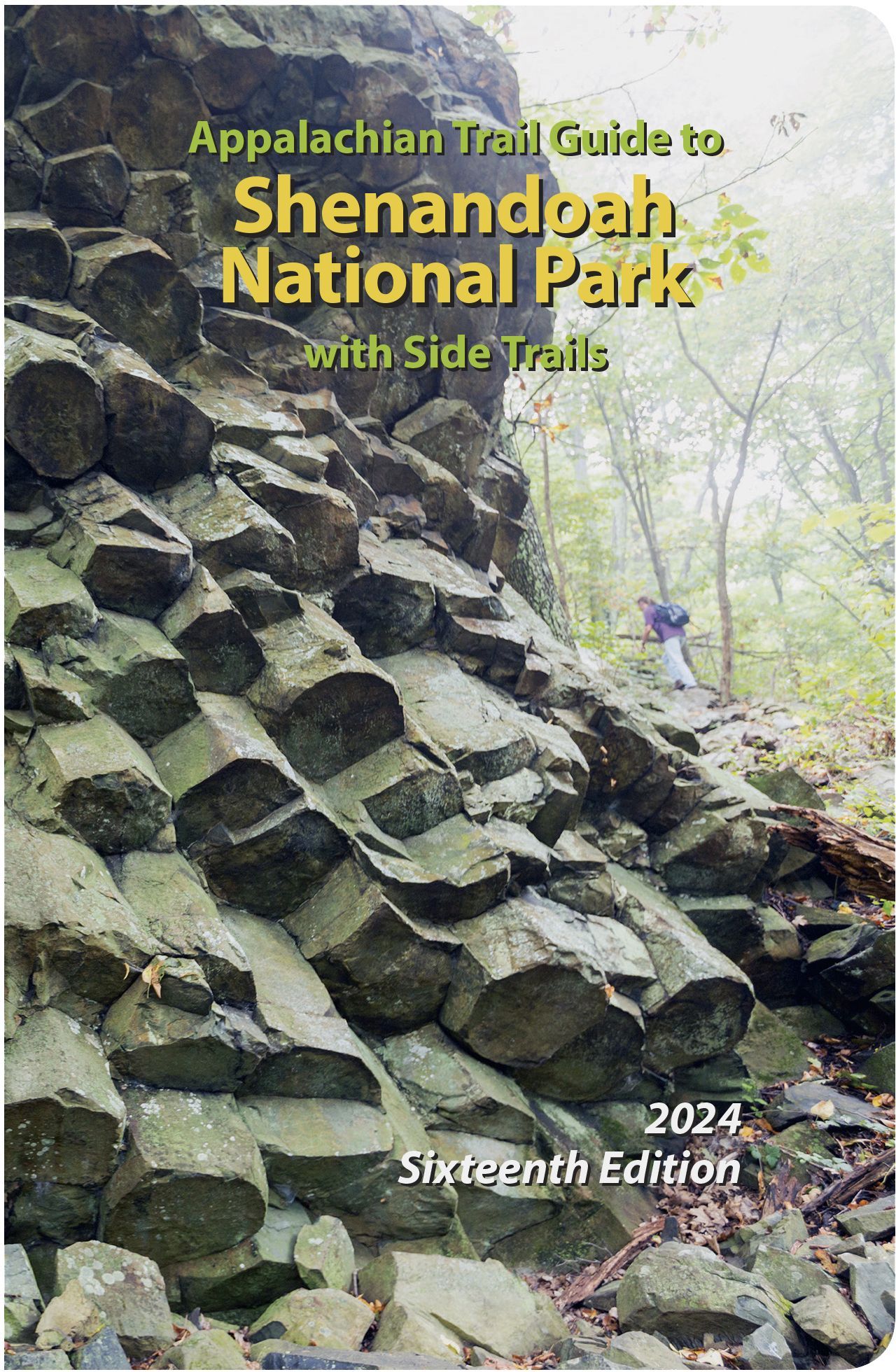
The sixteenth edition features a new cover and introduction from the new superintendent of SNP, J. Tracy Stakely, with his vision for the park. The cover is a photo of the large geologic formation of columnar basalt found on the south side trail off Compton Peak. This type of formation is found in other places in the park but this is by far the most stunning example. Compton Peak is located on the AT between the parking areas for Compton Gap and Jenkins Gap.
There have been a few notable changes to trails within the park since the prior edition. Some of the ones that have occurred include the elimination of the connector trail between Whiteoak Canyon Trail and Cedar Run, a few minor changes to Jeremys Run and Riprap Trails, changes associated with the Old Rag parking area and trail access, and updates on boundary closures. Numerous administrative changes in how to obtain permits for backcountry camping and backcountry regulations are included. Finally, additional cabins located in and around SNP, with brief descriptions, are now listed. The guide is 336 pages, which includes 35 photographs, elevation profile diagrams for each of the nine sections of the AT in the park, and overview maps for each of the three park districts (north, central, and south) for the AT and the 146 side trails.
The price for the new edition is unchanged from the prior one: retail price is $18 plus shipping and handling; member discount price is $14.40 plus shipping and handling.